KiwiWalks

Tongariro Alpine Crossing

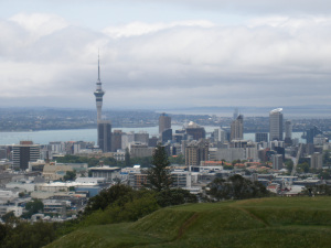
I got a nice surprise today! I was trawling through the Te Araroa website looking for my next walk, when I discovered that, all unbeknownst to me, the Tongariro Crossing was included. I actually did this walk several years ago, on New Year’s Day, and it still ranks for me as the best walk I’ve done – and that includes the Milford Track, which is popularly supposed to be the most spectacular in New Zealand. Anyway, I’m not about to repeat sections I’ve already done – it’s the same with the Milford Track (I want to do all the Great Walks, but have already done Milford and therefore don’t feel obliged to do it again). So that means I can tick off the Crossing.

It was a lovely sunny day when I did it, and I could see Mount Taranaki clearly from the top of the Devil’s Staircase. Walking through the South, Red, and Central Craters was amazing; Mount Doom (aka Ngauruhoe) satisfied my inner fangirl; and the tussock landscape around Ketetahi is just beautiful. (I spent several years on my OE and missed tussocks more than anything else, I think – I love the way they look, and fields of them waving in the wind somehow feels like home.) It’s a shame I’ve lost the photos, but I’ll be going back to Tongariro National Park sooner or later to do the Northern Circuit (another Great Walk) and that covers the same ground, really, as the Crossing, so I’ll take more then.

So that’s another tiny bit of Te Araroa shaved off. I’m feeling even more satisfied with the walk in retrospect, now.

KiwiWalks

Coast to Coast

Have left Dunedin for the warmer north, and am visiting my sister in Auckland for a couple of days. While I’m here I thought I’d do a bit more of Te Araroa – the Coast to Coast walkway. This goes from the ferry terminal in the heart of the CBD to Manukau Harbour; about 16 km in all. A relatively easy day.

OLYMPUS DIGITAL CAMERA

Heading out of the immediate shopping frenzy of Queen Street and the surrounding environs (including the spectacular Sky Tower, the tallest man-made building in New Zealand) I made my way up to the Auckland Domain. This is a multipurpose green space in the centre of the city, and lots of people were out enjoying it. The Auckland Museum is in the middle of the Domain, so I abandoned the walkway for a couple of hours to troll through it. They had dinosaurs! I was so excited. I could stare at dinosaur skeletons for hours.

After lunch at the Museum cafe, I headed across to Mount Eden, and hauled myself up to the crater. I’ve been there  a couple of times before, and always enjoy going. Mostly because, I admit, it caught my imagination as a young child, when I was reading Maurice Gee’s Under the Mountain, in which a red-headed twin throws a magic stone into the crater, thus bringing about the downfall of evil, quacking aliens called Wilberforces, who want to turn the entire Earth to mud. It’s better than I’m making it sound, truly. I loved that book.

An hour or so later I was doing the same thing at One Tree Hill (minus the sci-fi reminiscences of my childhood). One Tree Hill is a complete misnomer, I’m afraid. Firstly, because it’s lower slopes are covered with a lot more than a single tree. And secondly, because although it once had a single tree at the top, as far as I recall someone threw a tantrum and cut it down, so now there’s no tree at all. Grrrr. I’m a botanist at heart, and chopping down trees for the hell of it really pisses me off.

onetree

From OTH I trotted towards the end point, Onehunga Bay Reserve, a small park on the edge of Manukau Harbour and the end of the trail. A really good day, on a very well-done trail. I especially liked how as much of the walk as possible was through green spaces – it wasn’t just trekking through roads and obviously urban environments, which would have been easy to do. Got quite sunburnt, though. Must make sure not to forget my sunscreen again!

KiwiWalks

Turnbull Hut

Turnbull is a basic bivvy hut, the lowest grade of Department of Conservation huts. Four walls and a roof, plus fireplace and bunks and not much else. Nonetheless, it was chock-full of character, and had obviously been used and enjoyed for decades.

OLYMPUS DIGITAL CAMERA

I spent an extra day there, partly because after two very long days I was tired, and partly because I’d wrenched one of my ankles in all that bloody mud and could barely limp across the hut floor. Seriously, I couldn’t understand it. By some miracle it hadn’t rained for days, and yet mud was still stubbornly and deeply present, ever ready and waiting to try and take a boot. It nearly did, too. It must need an entire summer’s drought to dry up the last of it.

The area around the hut was the most beautiful I’d seen in the Longwoods – trees straight out of Fangorn Forest. And there was this beautiful little old dam which on its own was worth the entire walk: one of the prettiest little lakes I think I’ve ever seen.

OLYMPUS DIGITAL CAMERA

However, these two unscheduled extra days had left me short on food, so after another night at Turnbull I had to stumble back down to the end of Cascade Road. Amusingly, 15 minutes or so after I had left the hut (and, it must be said, this was, unlike PWR, a very well marked track, with blazes nearly every 5 m ((I amused myself thinking about Orange Gordon and his amazing trained pack-sheep, Bertha)) I came across a sign I had seen and cursed the day before yesterday. 5 MINUTES TO HUT. Needless to say it was wrong,  broken, and resting in a pool of mud, but some other annoyed and teased-beyond-endurance tramper had vandalised the sign to give a more accurate impression. I’m betting it wasn’t a Southlander.

Truly unfortunately – I still can’t understand how it happened – at the bottom of Cascade I got turned around and starting heading for hours down this horrible gravel road. Too late I realised I was nearly back at Riverton, rather than going onwards to Otaitai, but after a minute of reaction I shall not repeat I had to laugh. Hitched a ride on an empty schoolbus back to the Globe in Riverton, and gorged myself stupid on pizza and beer, before deciding that I think I’d had enough exercise for now, thank-you, and headed back to Dunedin.

KiwiWalks

Port Water’s Race, still

Waking early after my impromptu stayover in the mine-studded forests of Longwood, I made plans to get the hell out. Hopelessly lost and off path, and map seeming worse than useless, I breakfasted on chocolate and made the decision to head east. East was out, at any rate. So, with the helpful warnings of the Colac Bay pub-goers in my mind (“don’t get off track, there are old mines 50 foot deep you can plunge to your screaming death into”) I set off – being very careful about where I put my feet.

In a stroke of luck that I still can’t understand (having very stupidly wandered lost for a good hour the night before) within the hour I had stumbled onto the PWR track again. Unfortunately, it was a bit I’d already travelled – which meant that I still had the path of confusion before me. You’d think it would be fairly easy to follow a bloody great ditch, even when the path petered out, wouldn’t you? But if the thing is clogged, or there’s been a slip, or the path is for some reason impassable and you have to force your way through the bush around it and somehow hope for the best, well, things happen.

Coming again to the mystery spot, I somehow stumbled on the correct path. You see, you get to this river. On one side is a path that has obviously – from the state of the path itself, which is quite evident – led many unsuspecting people off into darkness and terror, while the real route, marked with a small scrap of cloth, is on the other side of the river, heading up a steep and overgrown bank with no evidence of a path at all. Again, it was force and hope – a theme to be repeated through much of the afternoon.

Then, stumbling along, a miracle. Cascade Road (a deserted farm track) appeared through the trees. No signage, of course. (And what Southlanders have against decent signage I don’t know – did it get them to a mother-in-law’s birthday party on time? – but there is apparently an immoveable regional grudge against it.) 31 hours after I started that supposedly 8 hour track I stumbled free of it, with a determined resolve never to take any Te Araroa guidelines seriously in future. 8 hours, bullshit.

I stumbled up Cascade towards Martin’s Hut, only to find that the promised clear signage was non-existent. I eventually found the track to Turnbull Hut, but only because the sign had not been removed entirely. Rather, it had been broken off and thrust head first into a gorse bush of gargantuan proportion. 1/2 hour to the hut, it said, and again: bullshit. I arrived 2 hours later, muddy to the bone, just as it was getting too dark to see, and you know what?

Turnbull Hut was worth it to the core.

KiwiWalks

Longwoods Ranges

I had high hopes for today. I thought it would be an interesting experience. Well, it was an interesting experience alright.

First, I had to tramp the 4 km or so of roading to get to Round Hill road, the entrance to the Long Hilly Track – which is neither long nor very hilly. The LHT is a historic walk through the bush site of old goldfields much favoured by the Chinese immigrants of the time. What was once a thriving little community – including hotels and pubs – is now gone, but there are some traces of the mining operations left. It’s a 2 hour return track, and is extremely well done, with information panels dotted around the place to tell you about its history. A lovely little walk.

About 45 minutes up, I came to the Port Water’s Race turn-off. PWR is a marvel of engineering – roughly 25 miles long (back before sensible metric) this finely sloping ditch channelled water for sluicing. Its gradient is so minimally perfect that the water moved slowly and easily through the bush, with no rushing or rapids – and for it to be hacked out of the earth and stone at the time (even tunneling through rock in some places) was no mean feat for poverty-stricken miners of the 19th century. Remnants of their presence are scattered along the track – like this old broken bridge.

OLYMPUS DIGITAL CAMERA

A sign at the beginning of PWR assured me that the section to Cascade Road should take me 8 hours. I don’t know what roadrunner did this trail in 8 hours, but it must have been in better condition then! Mud, mud everywhere, broken trees and debris all over the path, and – it has to be said – a very lackadaisical attitude to marking said path or giving any signage at all meant that, close to 12 hours after I started walking PWR I had to camp out under the shelter of an enormous dead tree, completely lost.

At least it wasn’t raining and I had the sense to bring supplies, but still. Was not amused. Thank goodness no bears or other nasties in NZ! I might have been grumpy, but at least I could go to sleep secure in the knowledge that, like Granny Weatherwax, the most dangerous thing in those woods was me.