KiwiWalks

Moturau and Manapouri

After a very long day yesterday (although I was surprised and pleased to find that there were two girls even slower than I was, hooray!) I had a nice long sleep-in at Iris Burn Hut this morning. Then, plastering my blisters, I set off on what would be a day of comparative ease – six hours of bushwalking through to Manapouri Lake and Moturau Hut.

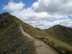
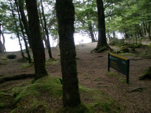
For once, my legs agreed with DOC’s estimate. Going along the flat, through lovely beech forest, I’m fairly speedy; it’s only on the big hill stretches (and both up and down have their own special little tortures) that I go all tortoise-like.

I didn’t take many good photos today, though. The weather forecast had come in at 8.30am, and it was continuous showers that would turn to full-bore rain early-to-mid afternoon. So I threw on my pack (feeling lighter as the days go by, all the food being eaten as I go and I’m just not that hungry anymore anyway) and try and make Moturau before the storm hits.

Which I do, by about ten minutes. Good timing, eh? At least the rain put paid to the sandflies, bloodthirsty little buggers.

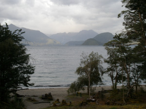
Moturau is on the edge of Lake Manapouri, which is apparently quite nice to swim in, though I was too lazy and comfortable inside to go and get all wet.

OLYMPUS DIGITAL CAMERA

KiwiWalks

Climbing Mount Luxmore

The second day doing Kepler Track, and this was the day I was most looking forward to – the alpine ridge section between Mount Luxmore and Iris Burn Huts. Luckily it was a very nice day, as the track can be hell in high winds and rain (people having to crawl along ridgelines with sheer drops either side).

But first, it was more uphill, as I wound along the hillside getting closer to the top of Mount Luxmore. More hills – you can imagine how pleased I was. Still, at least it was in the open so I could see where I was going, unlike yesterday’s forest hike. The track lay clear ahead, and the views down towards one of the arms of Te Anau lake were stunning.

OLYMPUS DIGITAL CAMERAOLYMPUS DIGITAL CAMERA


Eventually I reached the point where you get to turn off the track and take a quick side trip up to Mount Luxmore’s top. I scrambled to the top, and was quite impressed with myself – I’m really not very good with heights, and there was a strong wind near the summit that didn’t help matters. I stayed long enough to take a photo and then got down as quickly as I could.

OLYMPUS DIGITAL CAMERA


From here, it was mostly sidling along hillsides for a couple of hours, trying to walk daintily in clumping great boots through an avalanche zone. There were a couple of avalanche shelters along the way, where I stopped to have some chocolate and laugh at the keas (trying desperately to steal another tramper’s socks).

OLYMPUS DIGITAL CAMERAOLYMPUS DIGITAL CAMERA


Once I hit the ridgeline, it was a fairly easy walk, with fantastic views, until I hit the zig-zag from hell – a steep, endless, rocky downhill track that turned my knees and ankles to jelly. I was very, very glad to get my sunburnt self to Iris Burn Hut.

Though it could have been worse. Robbie, the Hut Ranger, had some stories to tell about the alpine section that were a little hair-raising. Not too long ago he’d been helping a school group over it in absolutely awful weather – one poor girl was so terrified she was huddled in a foetal position on the track and refusing to move. At least those of us sharing the hut had had good weather – Robbie had heard from Jeff over the radio, and the people walking a day behind us were not so lucky – it was so wet and windy at Luxmore that the entire hut was shaking.

I’m so very glad I missed that.

KiwiWalks

Tackling the Kepler

Off today to do the Kepler Track. This is the second of the Great Walks I’ve tried – I walked Milford Track several years back, and coincidentally they both start in the small Fiordland town of Te Anau.

After picking up my hut tickets from DOC (the Department of Conservation, who run the huts, and who sensibly insist that you book for the Great Walks) I headed off with my pack, which was stuffed with dehydrated meals and as light as I could make it (not nearly light enough).

It’s a 45 minute walk round Lake Te Anau to the Control Gates, where the Kepler starts. The Gates are part of a hydroelectric power scheme and help regulate the water heading down to Lake Manapouri.

The Kepler starts off easy enough – a one and a half hour walk along the lake, through lowland beech and podocarp forests, along to Brod Bay. I really enjoyed this, as beech forests (I’m talking Nothofagus, the southern beech, here, rather than the Fagus genus found in the northern hemisphere) are my very favourite type of forest. This was mostly red and mountain beech, with a few ferns and lots of moss.

OLYMPUS DIGITAL CAMERA


And lots of sandflies, but they can’t keep up with you enough to bite as long as you’re moving, so I left Brod Bay fairly quickly and came to what I was to later hear described as the Luxmore Grunt.

Three hours uphill, or so DOC describes it. That bloody slog took me five. Alright, so I’m not very fit, and alright, so elderly people were passing me every other minute (I swear they’re not just getting hip replacements; there’s some serious bionics going on in there somewhere). A long hard hike up to the bushline – light rain, but at least it kept me from getting too hot. Ten minutes prior to stumbling out of the forest and into the light, I came across Ranger Jeff from Luxmore Hut, out doing track maintenance with his shovel. He told me that it was only a few minutes further up to the bushline, and luckily for him he was telling the truth or I would have gone back and visited hell on him and the next seven generations of his family. Bloody hills.

After breaking out into tussockland, it was another (and comparatively easy) 45 minutes until my first night’s stop at Luxmore Hut. And was I ever pleased to see it.

hut

KiwiWalks

Centennial Highway

I actually walked this part of Kapiti Coast two or three weekends ago, but I forgot to update this blog, and I can’t remember the actual date so it’s going under today’s instead. What I do remember: it was sunny. I got burnt. It might be time to get a higher factor sunscreen in order to protect my lily-white self.

Anyway, it was quite a short walk – just a couple of hours along the coast, filling in the hole between two sections I’ve already done. Most of it was along State Highway 1, which as usual does not thrill me, but the view on the other side more than made up for it. Of all the highway sections I’ve seen in NZ, this is one of my favourites. The steep cliff on one side, and on the other the blue, blue Tasman Sea, with Kapiti Island in the distance… it’s just lovely. I basically walked along the coast up to Paekak as seen here:

OLYMPUS DIGITAL CAMERA


The prettiest part of the walk was near the beginning, down at the beach at Pukerua Bay. I’m going to drag my flatmate M. out on a picnic there sometime this summer if it kills me. She’s tough to persuade – doesn’t like the beach, thinks the sand squeaks like cornflour when she walks on it. Suck it up, I say. And wouldn’t you, for this?

OLYMPUS DIGITAL CAMERA

KiwiWalks

Northern Walkway 2

AKA Climbing Mt Kaukau (That Which Gifts Us With The Idiot Box).

Back in March, I made my way one sunny afternoon along part of Wellington’s Northern Walkway, before abandoning climbing to the tv transmitter at the top of Mt Kaukau in favour of ice-cream and Buffy the Vampire Slayer. Who wouldn’t do the same, I ask you? Today, on the one sunny day we’ve had after what feels like a month of endless bloody rain, I did the rest. Who knows when the opportunity will arise again… it’ll probably start raining again tomorrow.

I started where I left off walking from Porirua to Johnsonville, at the end of Old Coach Road. From there it was an easy walk up along the hilltops to Mt Kaukau. Despite the sun, it was windy and muddy but not hair-raising – which is good as my hair needs no help in that respect. There were a few people out walking their dogs, and one mad couple out running theirs, poor creatures. (Running is even less fun than going uphill, I can never understand why people do it. Are they masochists?) There were stunning views at the top, though – down one side was the city, and down the other a windmill-strewn vista looking out over Cook Strait to the South Island.

OLYMPUS DIGITAL CAMERA


From here, I left the NW to trot along the Skyline Track, wandering along the ridges, as while Wellington’s Te Araroa section goes mostly along the NW, it diverges in places and this is one of them. I was glad to spend some extra time up there as I was thoroughly enjoying myself. Most of that enjoyment, it must be said, was due to the kn0wledge that I was walking in the easy direction and it was all down hill from here, down Bell’s track and through the suburb of Ngaio to the local railway station, where I stopped last time I was on the NW. While it’s true that walking up hill and walking down hill both have their own special horrors, down is better than up any day in my book, and looking up at the tower from halfway down Bell’s track, I was smugly glad that I didn’t have to slog all the way up to it.