KiwiWalks

Rakiura Track

I’d forgotten about adding this to the tramping blog, so yay for being able to make posts in retrospect. Anyway, on the 19th of March I’d just come back from finishing another of DOC’s Great Walks: the three day Rakiura Track on Stewart Island.

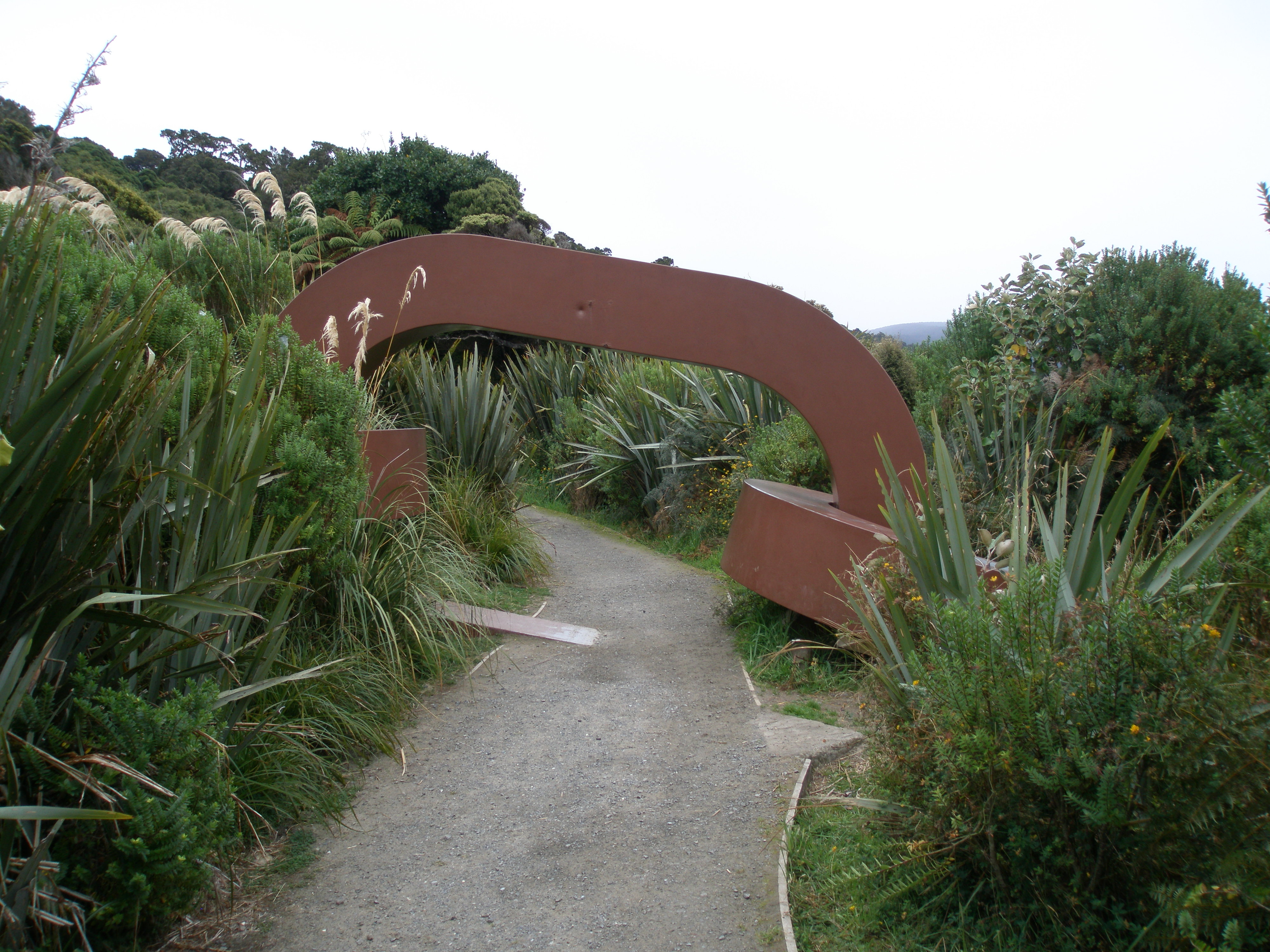
I’ve never been to SI before this – all in all I’ve never been so far south before. The only place more south at this point is Antarctica. So I took the ferry over from Bluff into Oban, and got a shuttle to the start of the track proper. Now you can walk the hour or two to the track start, but it’s all over roads and I’m just not that big a fan of road walking, so I passed all the far-less-lazy people and got to the start of the track in good time. It’s marked with one end of a big sculptured chain – the other end is across the Foveaux Strait in Bluff (I saw it when I walked the Bluff to Invercargill stretch of Te Araroa).

OLYMPUS DIGITAL CAMERA

The first day, from Lee Bay to Port William Hut, was an easy coastal walk through bush. Only 8km, so not strenuous at all. The big draw of walking on SI is the bird life – everyone tramping here hopes to see a kiwi, and at both of the huts people creep out at night to try and spot them. Unfortunately, I didn’t see one the entire trip, although to be fair that was largely due to weather. I doubt rain really bothers kiwi of the avian variety, but I’m not about to huddle outside in the cold damp for extended periods of time when I can be in the nice dry hut eating my way through brie and crackers. It’s not that I didn’t give it a go, I did, but I’ve seen kiwi  before if not in the wild and so there was a limit to my enthusiasm.

OLYMPUS DIGITAL CAMERA

The first day was enjoyable, but the second was not so good. Slightly more strenuous in that the 13km track to North Arm Hut leaves the coastline to cut over the hill, but it was the weather that was truly challenging. Rain and more rain, a solid drenching pour. Now I and my pack had waterproof coverings so that was fine, but I took glasses instead of contacts on this tramp and I could not see a thing. I had to stop every minute, sometimes literally, to wipe them off. It wouldn’t have been so bad on the flatter coastal parts of the track, but on steep slippery surfaces you really need to be able to see, so it was slow going. I grumbled and swore – a lot. Highlight of the day was seeing the old sawmill machinery left to rust in the bush. I enjoy old machinery, so it’s fun to be able to poke about it and have a good look.

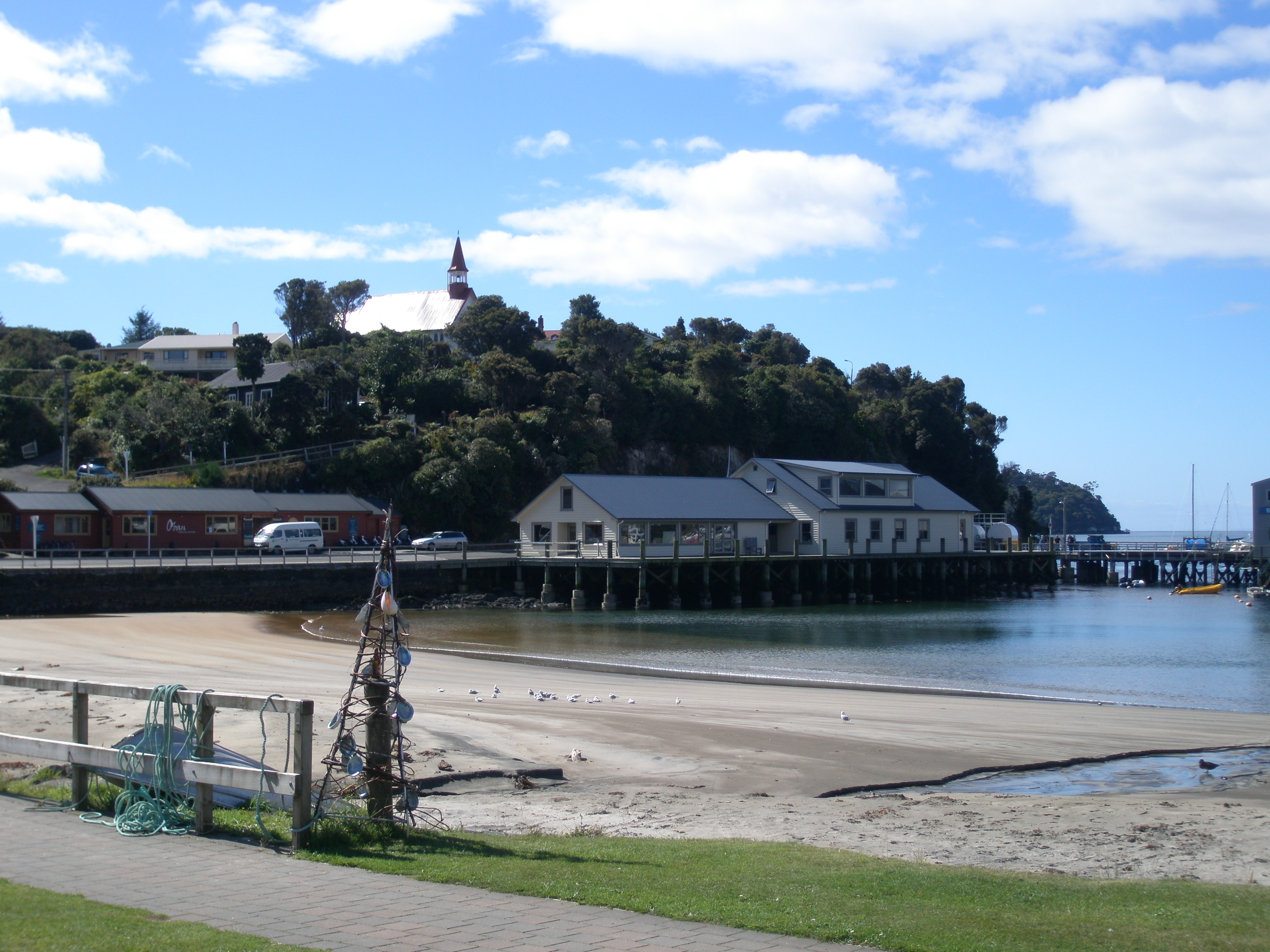
The last day was the best, I think. The weather had improved and the track was visible again, so I walked back into Oban – which is really such a pretty little town, I was quite struck with it – and had lunch at the pub before taking the ferry back to the mainland.

OLYMPUS DIGITAL CAMERA

Overall impressions of the track were mixed. It and the huts were constructed well, as always – I am never less than impressed with the work that DOC does, always high quality – and Stewart Island is indeed a lovely location. Rakiura Track is surely well worth doing. I do wonder, though, why it’s a Great Walk. Granted, I haven’t done them all but the ones I have done tend towards the absolutely spectacular: the alpine section of Kepler, the fjords of Milford, the deeply lovely Abel Tasman and the volcanic landscape of the Tongariro Plateau (alright, I haven’t done the Northern Traverse yet but I have done the Crossing and it’s the same environment). Compared to these, Rakiura is positively subdued. I wonder if the GW appellation is simply to get people to visit the National Park on Stewart Island? Well, more power to ’em, but Kepler remains the high point of my GW experiences thus far.


KiwiWalks

Distinct lack of disaster!

It’s only a 1.5 hour walk over the hills from Whariwharangi hut to the shuttle pick up point at Wainui Bay. In December last year, this northern part of the track was flooded with heavy damage, and you can see the time and effort that has gone into making the track walkable again. Over the hills the clay track (more a road in places) is quite bare, but it will soften down in time, as vegetation grows back.

Overall, I’ve been super impressed with the state of the track. The ATCT is by far the easiest of the Great Walks, I think, and has a lot of families go over it (where tramps like Kepler ban kids under ten) and the track is very well maintained.

Beautiful track, beautiful landscape, and an end to my streak of disaster! No broken bones or helicopters come to save me from hallucinations in the wilderness. Barely even a blister. Thank goodness for that! Can tramp again with confidence. The curse has been broken.

KiwiWalks

I am not a goat

Caught a lucky break this morning. I had to wait until low tide to cross the Awaroa estuary, which would have seen me reaching Whariwharangi hut just on sunset, but ranger Glenn arrived in his boat mid-morning and offered to give me a lift across. The bay is really stunning, and I was happy to get a view close up while the water was in. “You must love your job,” I said to Glenn, and, with a slow grin, he admitted that he really did. What a wonderful place to work (and live).

With the time pressure off, I dawdled along the track to Goat Bay. Some of the track getting there was not very wide – I wondered if they named the Bay because goats used to come along this path? Still, made it easily enough, but the track between Goat Bay and Totaranui was another story. There’d obviously been some recent landslides, and had to scramble across four of them in quick order. One was quite hairy (probably not for normal people, only those afraid of heights and stupid enough to look down when they shouldn’t) but met a couple of girls (from Belgium and Poland) halfway across the first one and they were very encouraging, so we navigated them together.

From then it was an easy three three hour walk to Whariwharangi hut. Now, this is the hut I had been most looking forward to – a converted homestead from the early 1900s. You can see the photo from DOC’s website here:

whariwharangi223Cute, eh? But totally infested with mice. (Rats too, from the comments in the hut book, but I didn’t stay long enough to see any.) Seeing the wee mice run along the common room floor was bad enough, but when I toddled off to bed, there were more crawling across my bunk! Good thing hut was empty – let out a screech that could have awakened the dead, grabbed my stuff, and went to sleep under the stars. Cold, but preferable. Lots of birdlife about – saw plenty of weka, and that made up for it.

KiwiWalks

Awaroa Bay

Didn’t wait for low tide this morning, so took the all-tide track around the estuary at Bark Bay (it only adds a few minutes) before a short steep climb to a saddle covered in manuka, where I couldn’t see the sea any more at all. That only lasted briefly, though, before descending to the old granite works (there’s only a few scattered foundations left) at Tonga Bay, then on to a lunch stop at Onetahuti Bay. There’s a tidal stream at the far end, but I’d timed it for low tide-ish and barely got the top of my boots wet.

Then it’s over Tonga Saddle and down to Awaroa Bay. The hut itself is half an hour along the beach from a rather more swanky lodge with cafe and restaurant, and foolishly I didn’t swing by there for ice-cream. By the time I’d made my way to the hut, over half an hour of sand in the boiling sun (and it’s quite difficult to walk on sand with boots and a big pack) I was too lazy to go back. Besides, I would have had to cross another tidal stream to get there (and back) and it was nearing the edge of the safety zone, time-wise, so didn’t bother.

Awaroa hut is, I think, the pick of the huts on the ATCT. Right on a very large estuary, the view from the front deck is stunning – either long stretches of sand or water that comes only a few metres from the door. And the hut is a veritable sun trap – warm and sunny, I barely needed the fire. This is also the first hut on the track I had entirely to myself – both Anchorage and Bark Bay had a handful of people, but Awaroa was entirely deserted, and very close to paradise.

KiwiWalks

Crossing to Bark Bay

Bloody camera battery given out again.

Got a bit of a sleep in this morning, waiting for the tide to be low enough to cross the estuary at Torrent Bay. Had fun squishing through the mud, but when it came time to take my boots off I skittered though the water as quickly as I could – it was freezing, despite the sunny weather, and cockles were scratchy underfoot. Saw quite a few little crabs about, and was careful not to step on them – poor things don’t deserve that!

There’s a tiny little village at Torrent Bay – reminders all over the track that it’s going through private land so not to stray. I know it’s winter, but the place was deserted – didn’t see a single soul. Slightly creepy, like Children of the Corn. Baking hot – I would have paid good money for an ice-cream if someone had been entrepreneurial enough to sell ‘em. Maybe they do in summer?

Then it’s through the bush and a couple of valleys to Falls River, where swings the 47m suspension bridge I have been looking forward to all morning. I love swing bridges, and so do a lot of people – as so often happens, you could hear the bridge before seeing it, at least, hear the delighted shrieks of trampers bouncing over it. Then down through the bush to Bark Bay hut, which sits on another estuary.